
Fix:Scandinavia-12th century.png
Grandia de esta previde: 507 × 599 pixeles Otra densias: 203 × 240 pixeles | 406 × 480 pixeles | 650 × 768 pixeles | 866 × 1,024 pixeles | 1,650 × 1,950 pixeles.
Fix orijinal (1,650 × 1,950 pixeles, grandia de fix: 340 KB, tipo MIME: image/png)
Resoma
| Descrive | |
| Fonte | Obra propre |
| Autor | Ningyou at Finnish Vicipedia |

|
File:Scandinavia-12th century.svg is a vector version of this file. It should be used in place of this PNG file when not inferior.
File:Scandinavia-12th century.png → File:Scandinavia-12th century.svg
For more information, see Help:SVG. |
 |
Lisensa
| I, the copyright holder of this work, release this work into the public domain. This applies worldwide. In some countries this may not be legally possible; if so: I grant anyone the right to use this work for any purpose, without any conditions, unless such conditions are required by law. |
Istoria de fix
Clica un data/ora per vide la fix en sua forma de alora.
| Data/Ora | Imajeta | Mesuras | Usor | Comenta | |
|---|---|---|---|---|---|
| aora | 19:19, 21 febrero 2007 | | 1,650 × 1,950 (340 KB) | Tene~commonswiki | Optimised (0) [Only tried 5 and 0] |
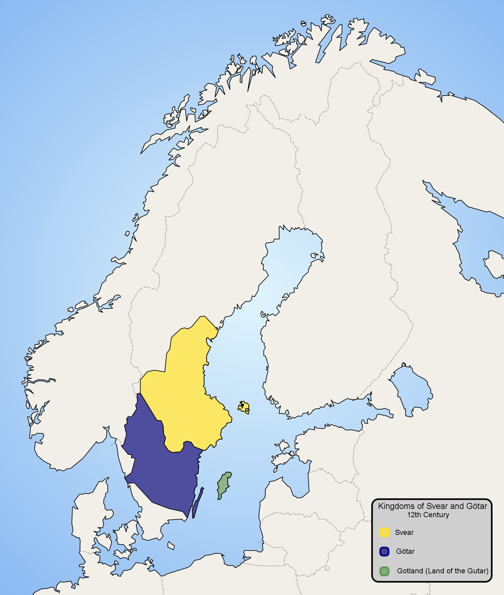
| 21:57, 13 janero 2006 |  | 1,650 × 1,950 (479 KB) | Ningyou | Map of Scandinavia in 12th century, showing modern borders in grey. Made by fi:Käyttäjä:Ningyou. Category:Maps of Sweden Category:Maps of Scandinavia |
Usas de fix
La paje seguente lia a esta fix:
Usa global de fix
La otra vicis seguente usa esta fix:
- Usa en af.wikipedia.org
- Usa en am.wikipedia.org
- Usa en ar.wikipedia.org
- Usa en arz.wikipedia.org
- Usa en ast.wikipedia.org
- Usa en azb.wikipedia.org
- Usa en az.wikipedia.org
- Usa en be-tarask.wikipedia.org
- Usa en be.wikipedia.org
- Usa en bg.wikipedia.org
- Usa en ca.wikipedia.org
- Usa en ckb.wikipedia.org
- Usa en cs.wikipedia.org
- Usa en cv.wikipedia.org
- Usa en da.wikipedia.org
- Usa en de.wikipedia.org
- Usa en en.wikipedia.org
- Usa en en.wiktionary.org
- Usa en eo.wikipedia.org
- Usa en es.wikipedia.org
- Usa en et.wikipedia.org
- Usa en eu.wikipedia.org
- Usa en fi.wikipedia.org
- Usa en fr.wikipedia.org
- Usa en fy.wikipedia.org
.png)
Mostra plu usas global de esta fix.