
Fix:Mongols-map.png
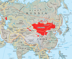
Grandia de esta previde: 722 × 599 pixeles Otra densias: 289 × 240 pixeles | 578 × 480 pixeles | 925 × 768 pixeles | 1,234 × 1,024 pixeles | 1,801 × 1,495 pixeles.
Fix orijinal (1,801 × 1,495 pixeles, grandia de fix: 2.79 MB, tipo MIME: image/png)
Resoma
| Descrive |
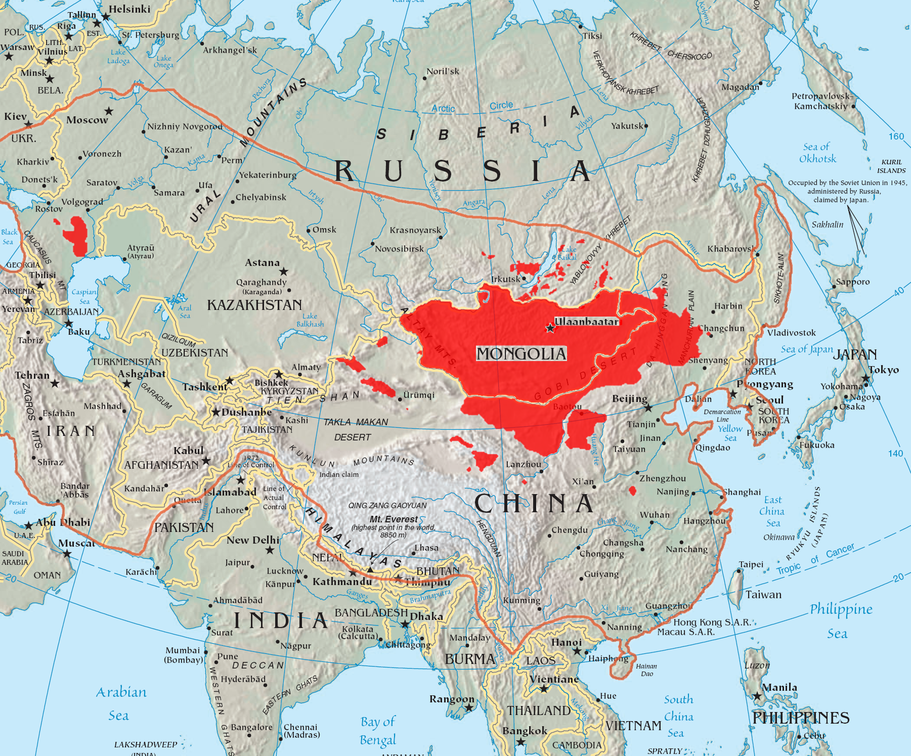
English: A map of the places that Mongol peoples live.
The orange line shows the extent of the Mongol Empire in the late 13th century. The red areas are the places dominated by ethnic Mongols. |
| Data | |
| Fonte |
|
| Autor | Quadell |

|
This linguistic map image could be re-created using vector graphics as an SVG file. This has several advantages; see Commons:Media for cleanup for more information. If an SVG form of this image is available, please upload it and afterwards replace this template with
{{vector version available|new image name}}.
It is recommended to name the SVG file “Mongols-map.svg”—then the template Vector version available (or Vva) does not need the new image name parameter. |
Lisensa
I, the copyright holder of this work, hereby publish it under the following licenses:

|
Permete es donada per copia, distribui e/o altera esta documento su la restrinjes de la GNU Free Documentation License, Varia 1.2 o cualce varia plu tarda publicida par la Free Software Foundation, sin partes nonvariante, sin testo de covrente fronte e sin testo de covrente retro. Un copia de la lisensa es incluida en la parte nomida GNU Free Documentation License. |
| Esta fix es lisensada su la lisensa Attribution-Share Alike 3.0 Unported de Creative Commons. | ||
| ||
| This licensing tag was added to this file as part of the GFDL licensing update. |
This file is licensed under the Creative Commons Attribution-Share Alike 2.0 Generic license.
- Tu es libre:
- per comparti – per copia, distribui e transmete la obra
- per remisca – per ajusta la obra
- Su la constrinjes seguente:
- atribui – Tu debe atribui la obra en la modo spesifada par la autor o lisensor (ma no en cualce modo cual sujesta ce el aproba tu o tua usa de la obra).
- share alike – Si tu altera, muta o developa plu esta obra, tu pote distribui la obra resultante sola su la mesma lisensa o un simil a esta.
Tu pote eleje la lisensa cual tu prefere
Istoria de fix
Clica un data/ora per vide la fix en sua forma de alora.
| Data/Ora | Imajeta | Mesuras | Usor | Comenta | |
|---|---|---|---|---|---|
| aora | 14:37, 29 maio 2023 | | 1,801 × 1,495 (2.79 MB) | Artanisen | High resolution map with the same borders and areas as version 17:34, 16 July 2005 (UTC) |
| 20:13, 10 april 2021 |  | 728 × 525 (279 KB) | Fæ | Reverted to version as of 17:34, 16 July 2005 (UTC) Untrusted work of sockpuppets | |
| 03:35, 17 janero 2019 |  | 728 × 525 (295 KB) | Anchuhu | mongol | |
| 10:56, 22 junio 2017 |  | 728 × 525 (630 KB) | 일성강 | Reverted to version as of 12:47, 1 June 2017 (UTC) | |
| 08:54, 17 junio 2017 |  | 728 × 525 (279 KB) | Calthinus | Reverted to version as of 17:34, 16 July 2005 (UTC) | |
| 12:47, 1 junio 2017 |  | 728 × 525 (630 KB) | 일성강 | fixed | |
| 17:34, 16 julio 2005 |  | 728 × 525 (279 KB) | Hottentot~commonswiki | This is a map of the places that Mongol peoples live. The information is based off of w:en:Image:Mongolsethnic.jpg, and the map I started with is w:en:Image:Asia-map.png. The orange line shows the extent of the Mongol Empire in the late 13th c | |
| 13:14, 16 julio 2005 |  | 728 × 525 (297 KB) | Quadell | This is a map of the places that Mongol peoples live. The information is based off of [:w:en:Image:Mongolsethnic.jpg]], and the map I started with is w:en:Image:Asia-map.png. The orange line shows the extent of the Mongol Empire in the late 13th ce |
Usas de fix
La paje seguente lia a esta fix:
Usa global de fix
La otra vicis seguente usa esta fix:
- Usa en af.wikipedia.org
- Usa en an.wikipedia.org
- Usa en ar.wikipedia.org
- Usa en arz.wikipedia.org
- Usa en ast.wikipedia.org
- Usa en azb.wikipedia.org
- Usa en ba.wikipedia.org
- Usa en be-tarask.wikipedia.org
- Usa en be.wikipedia.org
- Usa en bg.wiktionary.org
- Usa en bh.wikipedia.org
- Usa en br.wikipedia.org
- Usa en bs.wikipedia.org
- Usa en ca.wikipedia.org
- Usa en ckb.wikipedia.org
- Usa en cs.wikipedia.org
- Usa en cv.wikipedia.org
- Usa en da.wikipedia.org
- Usa en diq.wikipedia.org
- Usa en dsb.wikipedia.org
- Usa en el.wikipedia.org
- Usa en en.wikipedia.org
Mostra plu usas global de esta fix.