
Fix:Map Sudan BaD Juba.png
No densia plu alta es disponable.
Map_Sudan_BaD_Juba.png (776 × 350 pixeles, grandia de fix: 82 KB, tipo MIME: image/png)
Resoma
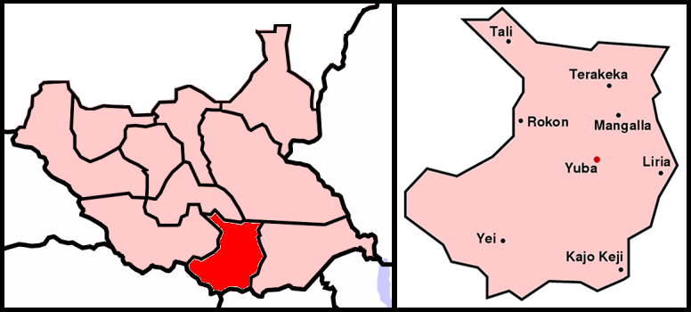
English: Map of Juba County and locator map of Juba city — in Central Equatoria state of the central Equatoria region of South Sudan.
Deutsch: Karte von Dschuba (South Sudan).
- Credits
- left image originally from Wikimedia Commons Image:Bahr_al-Dschabal.PNG
- right image is self-created
- created by de:Benutzer:Sven-steffen arndt
| I, the copyright holder of this work, release this work into the public domain. This applies worldwide. In some countries this may not be legally possible; if so: I grant anyone the right to use this work for any purpose, without any conditions, unless such conditions are required by law. |
Istoria de fix
Clica un data/ora per vide la fix en sua forma de alora.
| Data/Ora | Imajeta | Mesuras | Usor | Comenta | |
|---|---|---|---|---|---|
| aora | 12:26, 9 julio 2011 | | 776 × 350 (82 KB) | Wiki637 | 南蘇丹獨立 |
| 21:21, 15 julio 2005 |  | 918 × 524 (77 KB) | Sven-steffen arndt | :'''Description''': Map of Sudan, region Bahr al-Dschabal, city Juba :'''Beschreibung''': Karte von Sudan, Region Bahr al-Dschabal, Stadt Juba :left image originally from Wikimedia Commons Image:Bahr_al-Dschabal.PNG :right imag |
Usas de fix
La paje seguente lia a esta fix:
Usa global de fix
La otra vicis seguente usa esta fix:
- Usa en ar.wikipedia.org
- Usa en de.wikinews.org
- Usa en en.wikipedia.org
- Usa en fa.wikipedia.org
- Usa en he.wikipedia.org
- Usa en it.wikipedia.org
- Usa en ja.wikipedia.org
- Usa en lt.wikipedia.org
- Usa en ru.wikipedia.org
- Usa en sk.wikipedia.org
- Usa en smn.wikipedia.org
- Usa en uz.wikipedia.org
- Usa en www.wikidata.org