
Fix:MDG orthographic.svg

Grandia de esta previde PNG de esta fix SVG: 550 × 550 pixeles. Otra densias: 240 × 240 pixeles | 480 × 480 pixeles | 768 × 768 pixeles | 1,024 × 1,024 pixeles | 2,048 × 2,048 pixeles.
Fix orijinal (fix svg, densia: 550 × 550 pixeles, grandia: 1.2 MB)
Resoma
| Descrive |
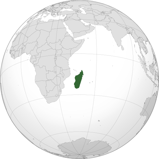
English: Orthographic map of Madagascar centered on Antananarivo
Official territory. Claimed territories. |
| Data | |
| Fonte | Obra propre with Natural Earth Data |
| Autor | Addicted04 |
| SVG genesis |
.svg)
.svg)
.svg)
.svg)
.svg)
.svg)
.svg)
.svg)
.svg)
.svg)
.svg)
.svg)
.svg)
.svg)
.svg)
.svg)
.svg)
.svg)
.svg)
.svg)
.svg)
.svg)
.svg)
.svg)
.svg)
.svg)
.svg)
.svg)
.svg)
.svg)
.svg)
.svg)
.svg)
.svg)
.svg)
.svg)
.svg)
.svg)
.svg)
.svg)
.svg)
.svg)
.svg)
.svg)
.svg)
.svg)
.svg)
.svg)
.svg)
.svg)
.svg)
.svg)
.svg)
.svg)
.svg)
.svg)
.svg)
.svg)
.svg)
.svg)
.svg)
.svg)
.svg)
.svg)
.svg)
.svg)
.svg)
.svg)
.svg)
.svg)
.svg)
.svg)
.svg)
.svg)

.svg)

.svg)

.svg)
.svg)
.svg)
.svg)
.svg)
.svg)
.svg)


.svg)
.svg)
.svg)
.svg)
.svg)
.svg)
.svg)

.svg)
.svg)
.svg)
.svg)
.svg)
.svg)
.svg)
.svg)
.svg)

.svg)
.svg)
.svg)
.svg)
.svg)
.svg)
.svg)
_without_national_boundaries.svg)
.svg)
.svg)
.svg)
.svg)
.svg)
.svg)

.svg)
.svg)
.png)
.svg)
.svg)
.svg)
.svg)

.svg)
.svg)
.svg)
.svg)
.svg)
.svg)
.svg)
.svg)
.svg)
.svg)
.svg)

.svg)
.svg)
.svg)
.svg)
.svg)
.svg)
.svg)
.svg)
.svg)

.svg)
.svg)

.svg)
.svg)
.svg)
.svg)
.svg)
.svg)
.svg)
.svg)
.svg)
.svg)
.svg)
.svg)
.svg)
.svg)
.svg)
.svg)
.svg)
.svg)
.svg)
.svg)
.svg)
.svg)
.svg)
.svg)
.svg)
.svg)
.svg)
_-_Crimea_disputed.svg)
.svg)
.svg)
.svg)
.svg)
.svg)
.svg)
.svg)
.svg)
.svg)
.svg)
.svg)
_political.svg)
.svg)
.svg)
.svg)
.svg)
_-_Crimea_disputed_-_no_borders.svg)
.svg)
.svg)
.svg)
.svg)
.svg)
.svg)
.svg)
.svg)
.svg)
.svg)
.svg)

.svg)
.svg)
.svg)

.png)
.svg)
.svg)
.svg)
.svg)
.svg)
.svg)
.svg)
.svg)
.svg)
.svg)
.svg)
.svg)
.svg)
.svg)
.svg)
.svg)
.svg)
.svg)
.svg)
.svg)
.svg)
.svg)
.svg)
.svg)
.svg)
.svg)
.svg)
.svg)
.svg)
.svg)
.svg)
.svg)
.svg)
.svg)
.png)
.svg)
.svg)
.svg)
_(orthographic_projection).png)
| Orthographic projections maps created by Ssolbergj |
|---|
| Orthographic projections maps created by Ssolbergj: |
.svg)
.svg)
Lisensa
I, the copyright holder of this work, hereby publish it under the following license:
This file is licensed under the Creative Commons Attribution 3.0 Unported license.
- Tu es libre:
- per comparti – per copia, distribui e transmete la obra
- per remisca – per ajusta la obra
- Su la constrinjes seguente:
- atribui – Tu debe atribui la obra en la modo spesifada par la autor o lisensor (ma no en cualce modo cual sujesta ce el aproba tu o tua usa de la obra).
Istoria de fix
Clica un data/ora per vide la fix en sua forma de alora.
| Data/Ora | Imajeta | Mesuras | Usor | Comenta | |
|---|---|---|---|---|---|
| aora | 14:18, 30 junio 2011 | | 550 × 550 (1.2 MB) | Addicted04 |
Usas de fix
La paje seguente lia a esta fix:
Usa global de fix
La otra vicis seguente usa esta fix:
- Usa en ar.wikipedia.org
- مدغشقر
- مستخدم:جار الله/قائمة صور مقالات العلاقات الثنائية
- العلاقات الأمريكية المدغشقرية
- العلاقات الأنغولية المدغشقرية
- العلاقات الكورية الجنوبية المدغشقرية
- العلاقات الإريترية المدغشقرية
- العلاقات السويسرية المدغشقرية
- العلاقات الألمانية المدغشقرية
- العلاقات الليختنشتانية المدغشقرية
- العلاقات البوليفية المدغشقرية
- العلاقات المدغشقرية الموزمبيقية
- العلاقات الألبانية المدغشقرية
- العلاقات البلجيكية المدغشقرية
- العلاقات الإثيوبية المدغشقرية
- العلاقات البيلاروسية المدغشقرية
- العلاقات الطاجيكستانية المدغشقرية
- العلاقات الروسية المدغشقرية
- العلاقات الرومانية المدغشقرية
- العلاقات الأرجنتينية المدغشقرية
- العلاقات الغامبية المدغشقرية
- العلاقات القبرصية المدغشقرية
- العلاقات السيراليونية المدغشقرية
- العلاقات المدغشقرية النيبالية
- العلاقات الليبيرية المدغشقرية
- العلاقات التشيكية المدغشقرية
- العلاقات المدغشقرية الميانمارية
- العلاقات العراقية المدغشقرية
- العلاقات البريطانية المدغشقرية
- العلاقات الكندية المدغشقرية
- العلاقات الكوبية المدغشقرية
- العلاقات الكورية الشمالية المدغشقرية
- العلاقات الكوستاريكية المدغشقرية
- العلاقات الكولومبية المدغشقرية
- العلاقات الكيريباتية المدغشقرية
- العلاقات الكينية المدغشقرية
- العلاقات اللاتفية المدغشقرية
- العلاقات اللاوسية المدغشقرية
- العلاقات اللبنانية المدغشقرية
- العلاقات اللوكسمبورغية المدغشقرية
- العلاقات الليبية المدغشقرية
- العلاقات الليتوانية المدغشقرية
- العلاقات الليسوتوية المدغشقرية
- العلاقات المالاوية المدغشقرية
- العلاقات المالطية المدغشقرية
- العلاقات المالية المدغشقرية
- العلاقات الماليزية المدغشقرية
- العلاقات المدغشقرية النيجيرية
- العلاقات المدغشقرية الناوروية
- العلاقات المدغشقرية المصرية
- العلاقات المدغشقرية الهندوراسية
Mostra plu usas global de esta fix.