
Fix:Indien physisch-politische Karte.svg

Grandia de esta previde PNG de esta fix SVG: 493 × 599 pixeles. Otra densias: 197 × 240 pixeles | 395 × 480 pixeles | 632 × 768 pixeles | 842 × 1,024 pixeles | 1,684 × 2,048 pixeles | 1,408 × 1,712 pixeles.
Fix orijinal (fix svg, densia: 1,408 × 1,712 pixeles, grandia: 4.77 MB)
| Descrive |
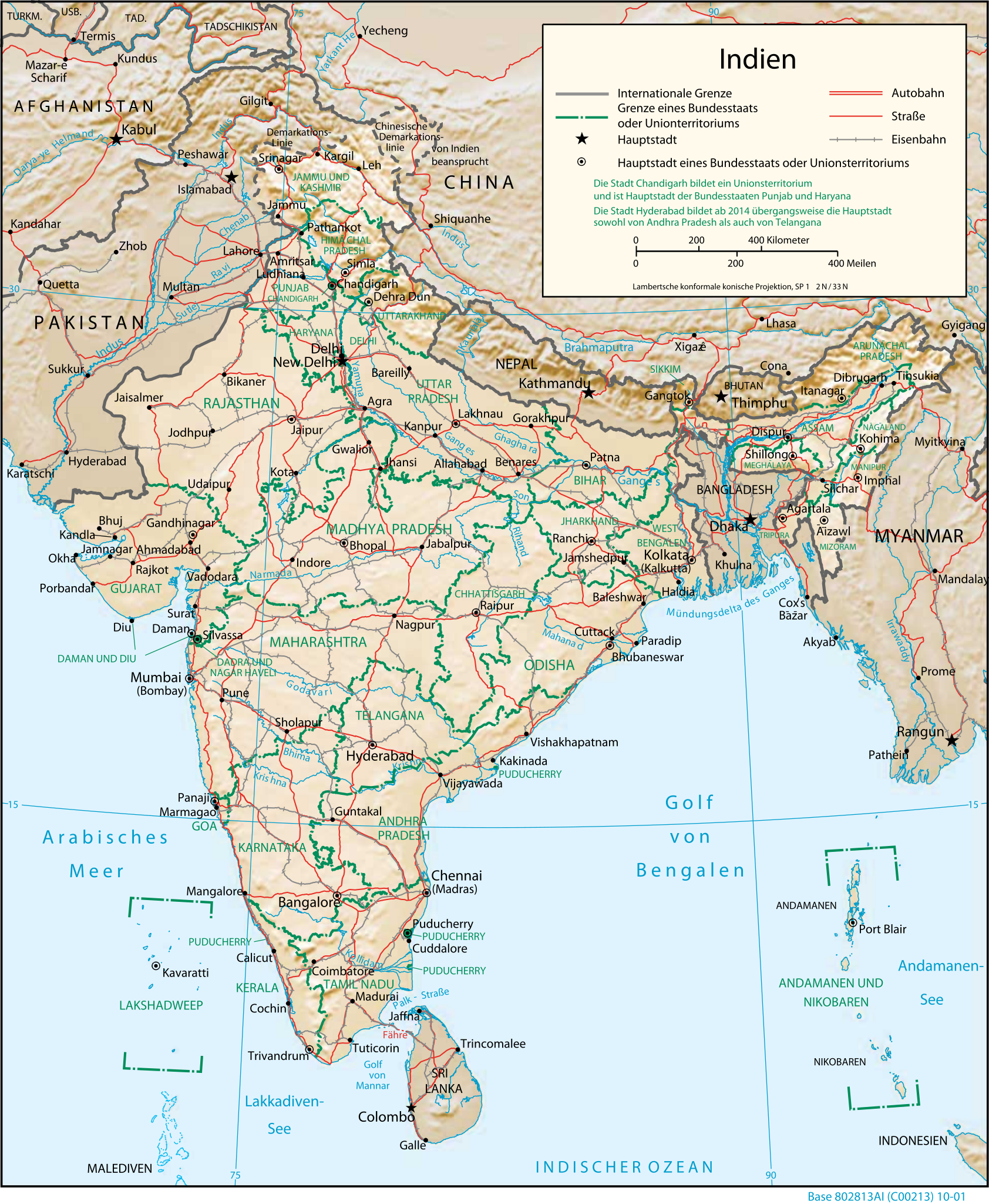
Deutsch: Physisch-geografische Karte Indiens |
|||
| Data | ||||
| Fonte | CIA map, modified by Furfur | |||
| Autor |
|
|||
| Permete (Reusante esta fix) |
|

Istoria de fix
Clica un data/ora per vide la fix en sua forma de alora.
| Data/Ora | Imajeta | Mesuras | Usor | Comenta | |
|---|---|---|---|---|---|
| aora | 04:19, 16 desembre 2014 | | 1,408 × 1,712 (4.77 MB) | Furfur | Skalierung Details |
| 04:04, 16 desembre 2014 |  | 939 × 1,141 (4.71 MB) | Furfur | {{Information |Description={{de|10Physisch-geografische Karte Indiens}} |Source=[https://www.cia.gov/library/publications/the-world-factbook/docs/refmaps.html CIA map], modified by Furfur |Date=2014-12-16 |Author=*CIA *modifications mad... |
Usas de fix
No pajes lia a esta fix.