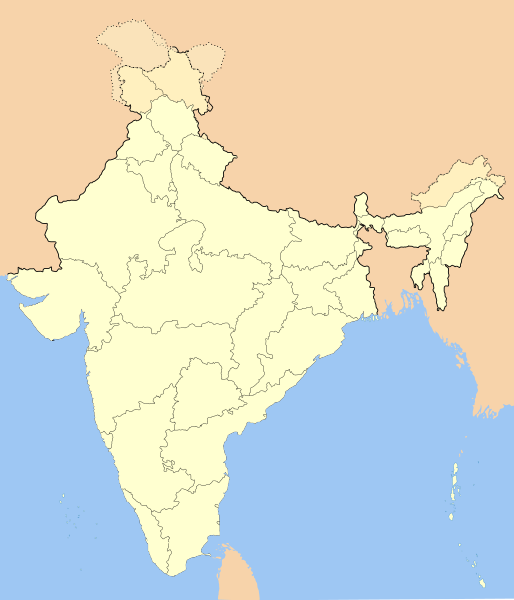
Fix:India-locator-map-blank.svg

Grandia de esta previde PNG de esta fix SVG: 514 × 600 pixeles. Otra densias: 206 × 240 pixeles | 411 × 480 pixeles | 658 × 768 pixeles | 877 × 1,024 pixeles | 1,755 × 2,048 pixeles | 1,486 × 1,734 pixeles.
Fix orijinal (fix svg, densia: 1,486 × 1,734 pixeles, grandia: 252 KB)
Istoria de fix
Clica un data/ora per vide la fix en sua forma de alora.
| Data/Ora | Imajeta | Mesuras | Usor | Comenta | |
|---|---|---|---|---|---|
| aora | 14:01, 14 otobre 2020 |  | 1,486 × 1,734 (252 KB) | NordNordWest | upd Telangana/Andhra Pradesh |
| 17:48, 25 julio 2020 |  | 1,486 × 1,734 (252 KB) | NordNordWest | Jammu and Kashmir/Ladakh | |
| 01:42, 1 april 2017 |  | 1,486 × 1,734 (337 KB) | Utcursch | Moved Telangana to states layer | |
| 14:08, 29 janero 2016 |  | 1,486 × 1,734 (379 KB) | Csyogi | Telangana update | |
| 15:36, 16 maio 2006 |  | 1,486 × 1,734 (421 KB) | Nichalp | Siachen edits | |
| 12:49, 13 maio 2006 |  | 1,486 × 1,734 (424 KB) | Nichalp | Siachen correction | |
| 12:43, 13 maio 2006 |  | 1,486 × 1,734 (422 KB) | Nichalp | border changes | |
| 05:53, 9 maio 2006 |  | 1,486 × 1,734 (421 KB) | Nichalp | Updates as suggested in FPC | |
| 07:48, 7 maio 2006 |  | 1,486 × 1,734 (421 KB) | Nichalp | Version 2; added some additional disputed areas in the Western sector | |
| 18:27, 6 maio 2006 |  | 1,486 × 1,734 (416 KB) | Nichalp | Blank locator map of India SVG Map drawn by me, ~~~~ category:Maps of India |
Usas de fix
La paje seguente lia a esta fix:
Usa global de fix
La otra vicis seguente usa esta fix:
- Usa en as.wikipedia.org
- Usa en as.wikiquote.org
- Usa en awa.wikipedia.org
- खाँचा:ज्ञानसन्दूक भारत कय क्षेत्र
- भारत कय राज्य
- भारत कय संघ राज्यक्षेत्र
- खाँचा:India States and Territories Labelled Map
- खाँचा:Infobox Indian Jurisdiction
- खाँचा:Infobox Indian Jurisdiction/Examples/city
- खाँचा:Infobox Indian Jurisdiction/Examples/district
- खाँचा:Infobox Indian Jurisdiction/Examples/neighbourhood
- खाँचा:Infobox Indian Jurisdiction/Examples/protected area
- खाँचा:Infobox Indian Jurisdiction/Examples/state
- खाँचा:Infobox Indian Jurisdiction/Examples/suburb
- खाँचा:Infobox Indian Jurisdiction/Examples/town
- खाँचा:Infobox Indian Jurisdiction/Examples/village
- खाँचा:Infobox Indian Jurisdiction/Sandbox
- खाँचा:Infobox Indian Jurisdiction/Sandbox/doc
- खाँचा:Infobox Indian Jurisdiction/doc
- खाँचा:ज्ञानसन्दूक भारत कय क्षेत्र/doc
- सीधी
- Usa en ban.wikipedia.org
- Usa en bn.wikipedia.org
- Usa en bpy.wikipedia.org
Mostra plu usas global de esta fix.


