
Fix:Cape Matapan.PNG

Grandia de esta previde: 680 × 600 pixeles Otra densias: 272 × 240 pixeles | 544 × 480 pixeles | 871 × 768 pixeles | 1,197 × 1,056 pixeles.
Fix orijinal (1,197 × 1,056 pixeles, grandia de fix: 212 KB, tipo MIME: image/png)
Resoma
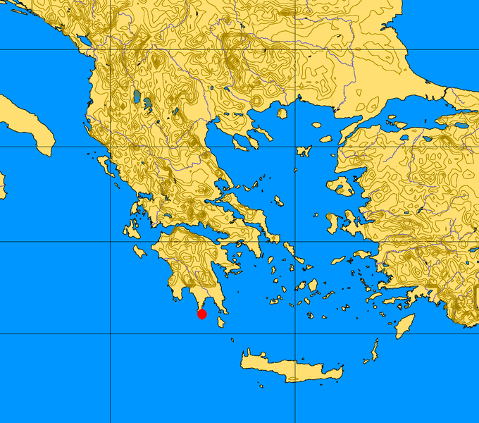
| Descrive | Greece map with Cape Matapan highlighted (the original Greece map used for it come from Commons :Image:Greece 34 43 17 30 blank map.png) |
| Data | |
| Fonte | Obra propre |
| Autor | TCY |
Lisensa
| I, the copyright holder of this work, release this work into the public domain. This applies worldwide. In some countries this may not be legally possible; if so: I grant anyone the right to use this work for any purpose, without any conditions, unless such conditions are required by law. |
Istoria de fix
Clica un data/ora per vide la fix en sua forma de alora.
| Data/Ora | Imajeta | Mesuras | Usor | Comenta | |
|---|---|---|---|---|---|
| aora | 13:49, 3 marto 2008 | | 1,197 × 1,056 (212 KB) | TCY | == Summary == {{Information |Description=Greece map with Cape Matapan highlighted (the original Greece map used for it come from Commons :Image:Greece 34 43 17 30 blank map.png) |Source=self-made |Date=March 2007 |Author= [[User: |
| 13:37, 3 marto 2008 |  | 1,197 × 1,056 (212 KB) | TCY | {{Information |Description=Greece Map with Cape Matapan highlighted (the original map uploaded from Commons (Image:Greece 34 43 17 30 blank map.png) |Source=self-made |Date=March 2007 |Author= TCY |Permission= |other_vers |
Usas de fix
La paje seguente lia a esta fix:
Usa global de fix
La otra vicis seguente usa esta fix:
- Usa en ca.wikipedia.org
- Usa en el.wikipedia.org
- Usa en en.wikipedia.org
- Usa en fi.wikipedia.org
- Usa en fr.wiktionary.org
- Usa en he.wikipedia.org
- Usa en id.wikipedia.org
- Usa en ja.wikipedia.org
- Usa en la.wikipedia.org
- Usa en no.wikipedia.org
- Usa en pt.wikipedia.org
- Usa en sh.wikipedia.org
- Usa en sv.wikipedia.org
- Usa en tr.wikipedia.org