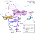
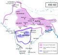
Fix:South Asia historical AD375 EN.svg

Grandia de esta previde PNG de esta fix SVG: 619 × 600 pixeles. Otra densias: 248 × 240 pixeles | 495 × 480 pixeles | 792 × 768 pixeles | 1,057 × 1,024 pixeles | 2,113 × 2,048 pixeles | 1,300 × 1,260 pixeles.
Fix orijinal (fix svg, densia: 1,300 × 1,260 pixeles, grandia: 775 KB)
Istoria de fix
Clica un data/ora per vide la fix en sua forma de alora.
| Data/Ora | Imajeta | Mesuras | Usor | Comenta | |
|---|---|---|---|---|---|
| aora | 04:46, 30 agosto 2014 |  | 1,300 × 1,260 (775 KB) | Woudloper | all text to paths |
| 04:28, 30 agosto 2014 |  | 1,300 × 1,260 (766 KB) | Woudloper | text to paths | |
| 04:27, 30 agosto 2014 |  | 1,300 × 1,260 (751 KB) | Woudloper | text converted to paths | |
| 04:23, 30 agosto 2014 |  | 1,300 × 1,260 (196 KB) | Woudloper | {{Information |Description ={{en|1=Political map of the Gupta Empire around 375, during the reign of Samudragupta. Sources used: *{{en}}{{aut|Agrawal, A.}}; '''1989''': ''Rise and Fall of the Imperial Guptas'', Motilal Banarsidass, ISBN 8120805925.... |
Usas de fix
La paje seguente lia a esta fix:
Usa global de fix
La otra vicis seguente usa esta fix:
- Usa en azb.wikipedia.org
- Usa en bn.wikipedia.org
- Usa en ca.wikipedia.org
- Usa en de.wikipedia.org
- Usa en en.wikipedia.org
- Usa en fa.wikipedia.org
- Usa en fr.wikipedia.org
- Usa en gl.wikipedia.org
- Usa en gu.wikipedia.org
- Usa en hi.wikipedia.org
- Usa en hu.wikipedia.org
- Usa en it.wikipedia.org
- Usa en ka.wikipedia.org
- Usa en kn.wikipedia.org
- Usa en ko.wikipedia.org
- Usa en ne.wikipedia.org
- Usa en or.wikipedia.org
- Usa en pt.wikipedia.org
- Usa en simple.wikipedia.org
- Usa en sl.wikipedia.org
- Usa en sq.wikipedia.org
- Usa en ta.wikipedia.org
- Usa en te.wikipedia.org
- Usa en ur.wikipedia.org
Mostra plu usas global de esta fix.


