
Fix:Occitania blanck map.PNG
No densia plu alta es disponable.
Occitania_blanck_map.PNG (573 × 397 pixeles, grandia de fix: 10 KB, tipo MIME: image/png)

|
This linguistic map image could be re-created using vector graphics as an SVG file. This has several advantages; see Commons:Media for cleanup for more information. If an SVG form of this image is available, please upload it and afterwards replace this template with
{{vector version available|new image name}}.
It is recommended to name the SVG file “Occitania blanck map.svg”—then the template Vector version available (or Vva) does not need the new image name parameter. |
Resoma
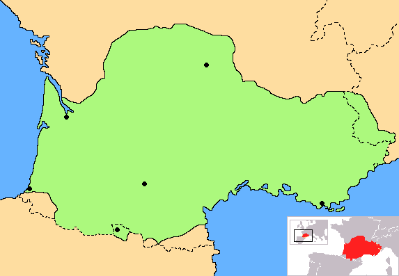
| Descrive | Correct map of Occitania, with geographic context and remarking of the country borders |
| Data | |
| Fonte | Obra propre |
| Autor | Norrin strange |
| Other versions | Derivative works of this file: Occitania aranes map.png |
I, the copyright holder of this work, hereby publish it under the following licenses:

|
Permete es donada per copia, distribui e/o altera esta documento su la restrinjes de la GNU Free Documentation License, Varia 1.2 o cualce varia plu tarda publicida par la Free Software Foundation, sin partes nonvariante, sin testo de covrente fronte e sin testo de covrente retro. Un copia de la lisensa es incluida en la parte nomida GNU Free Documentation License. |
| Esta fix es lisensada su la lisensa Attribution-Share Alike 3.0 Unported de Creative Commons. | ||
| ||
| This licensing tag was added to this file as part of the GFDL licensing update. |
Tu pote eleje la lisensa cual tu prefere
Istoria de fix
Clica un data/ora per vide la fix en sua forma de alora.
| Data/Ora | Imajeta | Mesuras | Usor | Comenta | |
|---|---|---|---|---|---|
| aora | 18:30, 27 junio 2023 | | 573 × 397 (10 KB) | Jfblanc | Improved boundaries |
| 22:10, 4 setembre 2020 |  | 573 × 397 (4 KB) | TSamuel | Minimized colors to 7 to recompress further | |
| 22:08, 4 setembre 2020 |  | 573 × 397 (5 KB) | TSamuel | Losslessly recompressed | |
| 16:32, 17 febrero 2009 |  | 573 × 397 (12 KB) | Tripallokavipasek | ||
| 15:21, 14 julio 2007 |  | 573 × 397 (11 KB) | Norrin strange | {{Information |Description=Correct map of Occitania |Source=self-made |Date=14-07-07 |Author= Norrin strange }} {{GFDL-Self}} |
Usas de fix
La paje seguente lia a esta fix:
Usa global de fix
La otra vicis seguente usa esta fix:
- Usa en ace.wikipedia.org
- Usa en ady.wikipedia.org
- Usa en am.wikipedia.org
- Usa en an.wikipedia.org
- Usa en ar.wikipedia.org
- Usa en be.wikipedia.org
- Usa en br.wikipedia.org
- Usa en ca.wikipedia.org
- Usa en ce.wikipedia.org
- Usa en ckb.wikipedia.org
- Usa en cs.wikipedia.org
- Usa en cv.wikipedia.org
- Usa en cy.wikipedia.org
- Usa en da.wikipedia.org
- Usa en diq.wikipedia.org
- Usa en en.wiktionary.org
- Usa en eo.wikipedia.org
- Usa en eo.wikinews.org
- Usa en es.wikipedia.org
- Usa en et.wikipedia.org
- Usa en eu.wikipedia.org
- Usa en fa.wikipedia.org
- Usa en fi.wikipedia.org
- Usa en fr.wikipedia.org
- Usa en fr.wiktionary.org
- Usa en fur.wikipedia.org
- Usa en gd.wikipedia.org
- Usa en gl.wikipedia.org
- Usa en gv.wikipedia.org
- Usa en hr.wikipedia.org
- Usa en hr.wiktionary.org
- Usa en hsb.wikipedia.org
- Usa en hu.wikipedia.org
- Usa en hy.wikipedia.org
- Usa en id.wikipedia.org
- Usa en ilo.wikipedia.org
- Usa en io.wikipedia.org
Mostra plu usas global de esta fix.