
Fix:Chesapeakelandsat.jpeg
Grandia de esta previde: 800 × 600 pixeles Otra densias: 320 × 240 pixeles | 640 × 480 pixeles | 1,024 × 768 pixeles.
Fix orijinal (1,024 × 768 pixeles, grandia de fix: 164 KB, tipo MIME: image/jpeg)
Resoma
| Descrive |
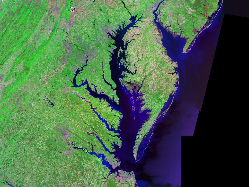
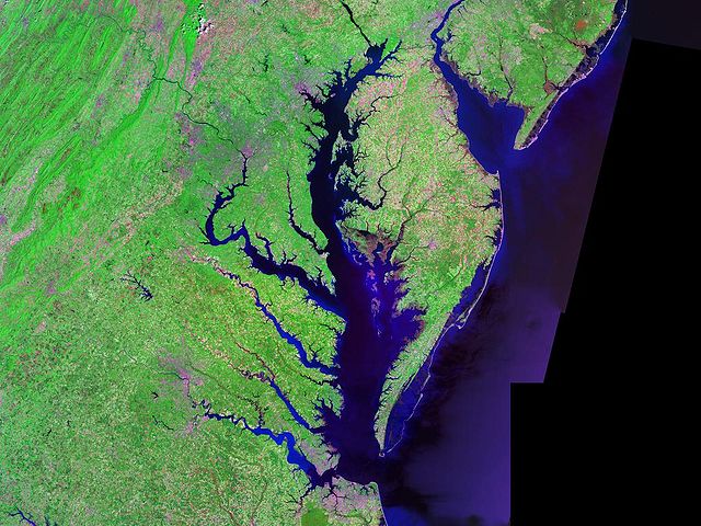
English: Satellite (Landsat) picture of Chesapeake Bay (center) and Delaware Bay (upper right) - and Atlantic coast of the central-eastern United States. |
| Data | circa 2000 |
| Fonte | Landsat photo, from circa 2000. Generated via [1] from NASA data |
| Autor | Landsat/NASA |
| Other versions |

Lisensa
| This file is in the public domain in the United States because it was solely created by NASA. NASA copyright policy states that "NASA material is not protected by copyright unless noted". (See Template:PD-USGov, NASA copyright policy page or JPL Image Use Policy.) | ||
 |
Warnings:
|
Istoria de fix
Clica un data/ora per vide la fix en sua forma de alora.
| Data/Ora | Imajeta | Mesuras | Usor | Comenta | |
|---|---|---|---|---|---|
| aora | 07:54, 24 febrero 2005 | | 1,024 × 768 (164 KB) | Balcer~commonswiki | Chesapeake Bay Landsat photo |
Usas de fix
La paje seguente lia a esta fix:
Usa global de fix
La otra vicis seguente usa esta fix:
- Usa en af.wikipedia.org
- Usa en ang.wikipedia.org
- Usa en ar.wikipedia.org
- Usa en ast.wikipedia.org
- Usa en az.wikipedia.org
- Usa en be.wikipedia.org
- Usa en bg.wikipedia.org
- Usa en br.wikipedia.org
- Usa en ca.wikipedia.org
- Usa en ceb.wikipedia.org
- Usa en da.wikipedia.org
- Usa en de.wikipedia.org
- Usa en en.wikipedia.org
- Usa en eo.wikipedia.org
- Usa en es.wikipedia.org
- Usa en et.wikipedia.org
- Usa en eu.wikipedia.org
- Usa en fa.wikipedia.org
- Usa en fi.wikipedia.org
- Usa en frr.wikipedia.org
- Usa en fr.wikipedia.org
- Usa en fy.wikipedia.org
- Usa en he.wikipedia.org
- Usa en hu.wikipedia.org
- Usa en id.wikipedia.org
- Usa en it.wikipedia.org
- Usa en ja.wikipedia.org
- Usa en ka.wikipedia.org
- Usa en ko.wikipedia.org
- Usa en la.wikipedia.org
Mostra plu usas global de esta fix.